Alaska-Canada Adventure Ride
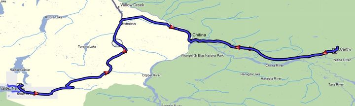
Day 18 - Valdez, Alaska to McCarthy Alaska (out and back), and then to Liberty Creek campground near Chitina, Alaska (258 miles)
 We
were starting to get more practice with breaking camp in the rain and how to minimize what gets wet. The first thing to do when getting out of your sleeping bag is to
roll it up along with your liner and sleeping pad. Then put on your riding gear including your jacket and boots
before you leave the protection of your tent. I also brought a wide brim rain hat to wear when standing around camp in the rain. After breakfast pack everything out of the tent into your panniers and dry bags, next pack the tent under the rain fly separately, and finally stashing the rain fly under a cargo net on the tail of the bike where it will stay separated from all your dry stuff (including the rest of the tent). Then during later stops when the rain has stopped, pull the fly out and drape it over your bike to try to dry it out. This may take several iterations across multiple stops, but usually it will result in your stuff not getting mildew or that undesired wet towel smell.
We
were starting to get more practice with breaking camp in the rain and how to minimize what gets wet. The first thing to do when getting out of your sleeping bag is to
roll it up along with your liner and sleeping pad. Then put on your riding gear including your jacket and boots
before you leave the protection of your tent. I also brought a wide brim rain hat to wear when standing around camp in the rain. After breakfast pack everything out of the tent into your panniers and dry bags, next pack the tent under the rain fly separately, and finally stashing the rain fly under a cargo net on the tail of the bike where it will stay separated from all your dry stuff (including the rest of the tent). Then during later stops when the rain has stopped, pull the fly out and drape it over your bike to try to dry it out. This may take several iterations across multiple stops, but usually it will result in your stuff not getting mildew or that undesired wet towel smell.
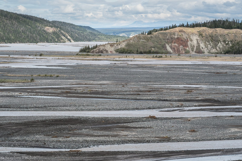
After riding back over the pass from Valdez, the rain dissipated. We then headed to the town of Chitina, and then onward to the town of McCarthy and the Kennecott Mine at the end of the Edgerton Highway. This road is dirt from Chitina to McCarthy with some scenic aspects to it, including a large wooden trestle bridge that used to support the railroad out to the Kennecott Mine. One of the most interesting is the crossing of the Copper River, vast in size, and renowned for its salmon run.
When you reach the end of the road, you are met with a narrow bridge only wide enough for pedestrians and motorcyclists. It is kind of a funny arrangement created by the locals in order to minimize car traffic into the town of McCarthy and provide another source of revenue for some enterprising individuals. They have a taxi service that charges to give people rides from the bridge into town (about 2.5 miles away) or the Kennecott Mine (another 3 miles). Unbeknownst to most visitors is that there is a separate vehicle bridge about a mile downriver that the locals use for their cars. But with the motorcycle, none of this false economy BS matters.
Exploring the Kennecott Mine should be on any visitors agenda to the area. At one time, it was the largest copper mine in North America, with the mining company going to great lengths to support this mine in the form of a railroad and rather impressive mining facilities. In the background you will see remains of the rather large glacier till from the Kennecott Glacier that has since receded almost out of view. Be sure to check out the power plant within the mining grounds. It is a wonder to think how this was constructed and maintained in such a harsh environment and so remote from the rest of civilization.
After an early yet delicious dinner at the Potato cafe in McCarthy, we headed back west on the Edgerton Highway to Chitina. Ultimately getting a campsite about 10 miles past Chitina at Liberty Falls. I learned of this place during an earlier trip a few years back when visiting this area after spending a week sea kayaking Glacier Bay. Previously I have also camped at an ad-hoc campground at the bridge for McCarthy that some enterprising local was charging for. But it has no real facilities, limited flat areas for a tent, and questionable on who even own the land.
Images (click to select the larger view at bottom)


All content and images are property of Stephen Fischer Photography, copyright 2019 - 2020. Last updated: 1/10/2020