Picture of the week
| Previous weeks |
 Dec
27, 2021 Dec
27, 2021 |
 Dec
13, 2020 Dec
13, 2020 |
 Nov
22, 2020 Nov
22, 2020 |
 Nov
8, 2020 Nov
8, 2020 |
 Oct
25, 2020 Oct
25, 2020 |
 Oct
18, 2020 Oct
18, 2020 |
 Sep
13, 2020 Sep
13, 2020 |
 Aug
23, 2020 Aug
23, 2020 |
 July
19, 2020 July
19, 2020 |
 July
5, 2020 July
5, 2020 |
 May
24, 2020 May
24, 2020 |
 May
10, 2020 May
10, 2020 |
 Apr
12, 2020 Apr
12, 2020 |
| Older |
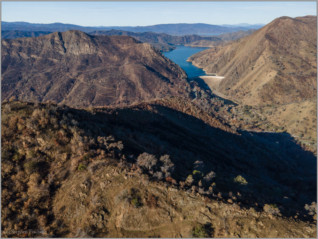
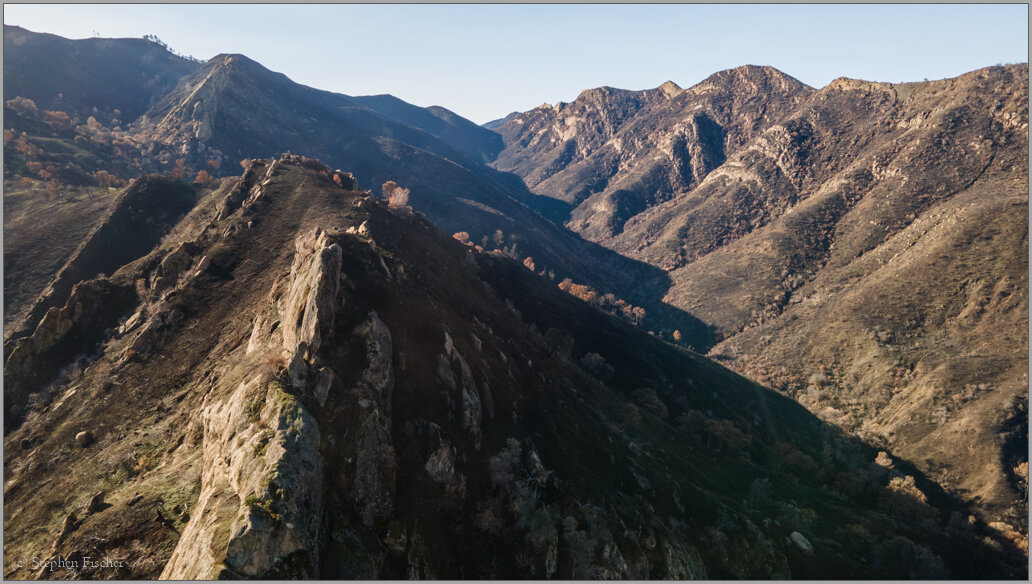
Fire damage above Lake Berryessa
 An aerial view of the burned out area in the mountainous terrain
surrounding Lake Berryessa in Northern California. Damaged by the recent
wildfires that raged through this area last August through
October in the form of the
LNU Complex and
Glass Fires. In
the image above this year's fires did the damage on the left
(south) side of the lake, while the area to the right was burned
a couple of years earlier. The insert image here to the
right was the last one captured by one of PG&E's webcams on the
top of Mt. Vaca that is in this same general area just southeast
of Lake Berryessa.
An aerial view of the burned out area in the mountainous terrain
surrounding Lake Berryessa in Northern California. Damaged by the recent
wildfires that raged through this area last August through
October in the form of the
LNU Complex and
Glass Fires. In
the image above this year's fires did the damage on the left
(south) side of the lake, while the area to the right was burned
a couple of years earlier. The insert image here to the
right was the last one captured by one of PG&E's webcams on the
top of Mt. Vaca that is in this same general area just southeast
of Lake Berryessa.
This week I traveled through the Putah Creek canyon and then dropped into Napa and Sonoma Valleys, exploring the impact of these fires by motorcycle and with the help of a drone. While the rugged terrain in the Lake Berryessa region got more cleanly wiped out, it is also more sparsely populated. The Glass Fire damage in the Napa and Sonoma Valleys was more random, with some structures spared next to other structures that survived. Those up on the ridges within or on the edges of the forests saw the most damage. Most of the structures down on the valley floor were spared given their further distance from more dense vegetation and the surrounding vineyards that don't seem as combustible.
Although it may seem that there will be a lower probability of future fires doing as much damage as these based on the assumption of what has already been burned, I am still seeing quite a few areas still unscathed and covered in dense vegetation within Sonoma and Napa counties. Upcoming years are likely to continue to be a game of Russian Roulette for those living within these wildland boundaries.
More images (click to select the larger view at the bottom)


All content and images are property of Stephen Fischer Photography, copyright 2010-2021. Last updated: 1/10/2021 ()