Alaska-Canada Adventure Ride
Day 23 - Stewart, British Columbia to Co-op Lake (east of Burns Lake), British Columbia
(316
miles)
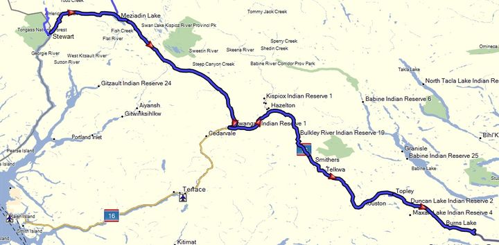 Getting a slow start after doing another resupply in town, we headed out to the Meziadin Junction, and then down the rest of the Cassiar Highway (37) to
Kitwanga. On the Cassiar I finally captured a reasonable
quality photo of a black bear that I spied off the side of the road foraging behind a
building. After pulling over, getting my big lens out, I was able to get on
the bike again, doubling back, and coast up to an open view of it, getting a
few shots before it wandered back into the woods.
Getting a slow start after doing another resupply in town, we headed out to the Meziadin Junction, and then down the rest of the Cassiar Highway (37) to
Kitwanga. On the Cassiar I finally captured a reasonable
quality photo of a black bear that I spied off the side of the road foraging behind a
building. After pulling over, getting my big lens out, I was able to get on
the bike again, doubling back, and coast up to an open view of it, getting a
few shots before it wandered back into the woods.
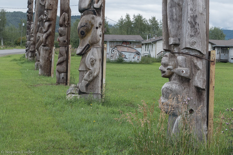
Later, after doing a bit of photography of the beautiful native totem poles on the north side of the Skeena River at the Gitwangak Reservation, we moved on via Highway 16 to the east. It was interesting to note these authentic native totem poles being over 175 years old and just out in the open with no apparent protection around them from vandalism or theft, yet all appeared unscathed. This is in stark contrast to what I would expect down in the states, and perhaps a statement on the contrast between the two societies?
From Kitwanga on, the weather was starting dry out as we headed east on Highway 16 towards Prince George. The days riding from then on was rather uneventful as we passed through pleasant and rural lands, eventually finding a reasonable place to camp along Co-op lake east of the more popular Burns Lake. This area ended up being quite peaceful, with many wildflower species and native bees about, leading to some quality photography time. I was also starting to notice that it was getting dark at a more reasonable time, leading to a better sleep cycle through the night without having to drape a shirt over my head to block out the light.
Images (click to select the larger view at bottom)


All content and images are property of Stephen Fischer Photography, copyright 2019 - 2020. Last updated: 1/27/2020